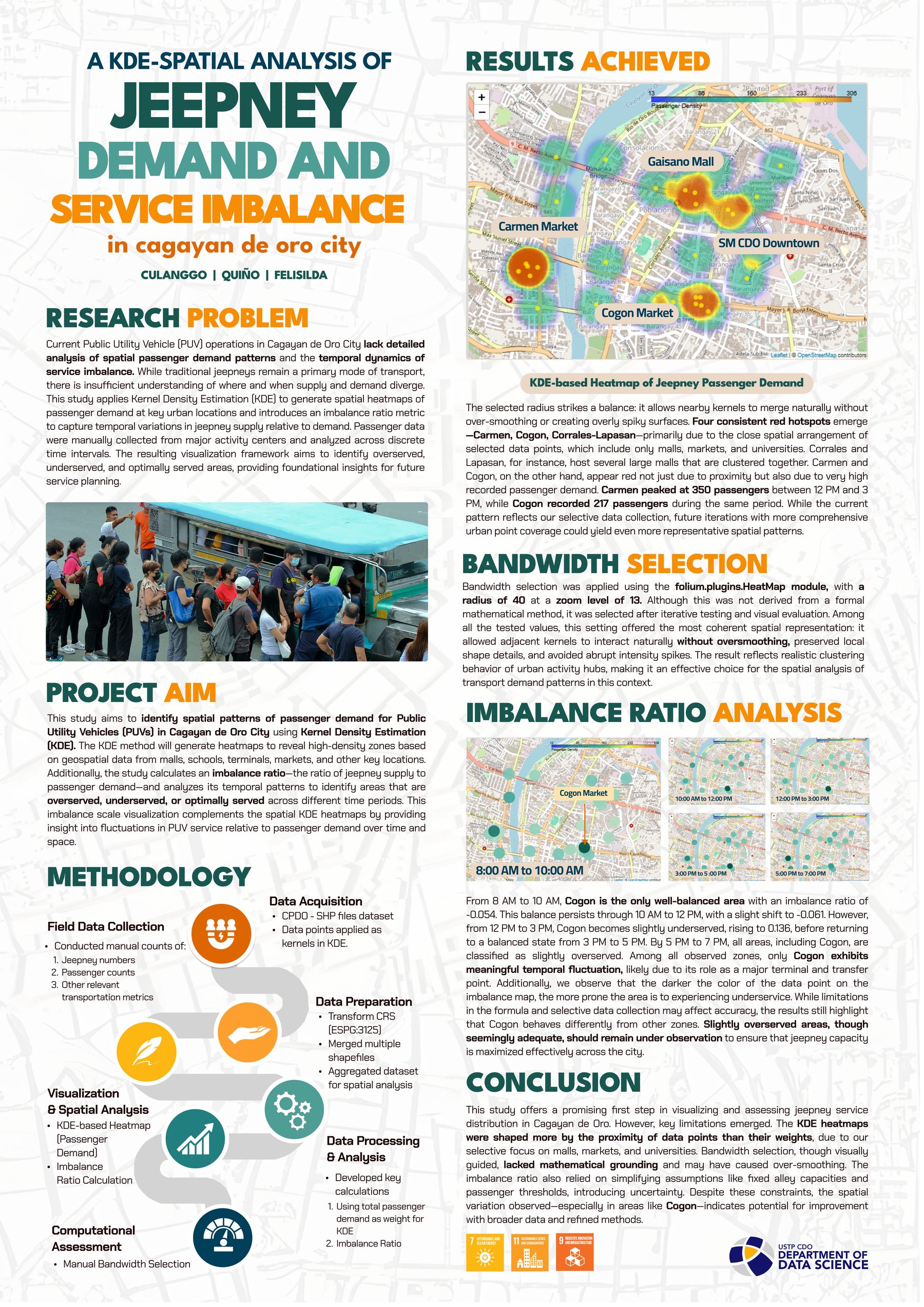
Overview
Public Utility Vehicles (PUVs), particularly jeepneys, are the backbone of daily commuting in Cagayan de Oro City — but operations are marked by traffic congestion, uneven route utilization, and long passenger wait times, worsened by gaps in the city's Local Public Transport Route Plan. This study applies Kernel Density Estimation to spatial and temporal passenger-demand data to visualize high- and low-demand zones across the city.
We built a GIS-based system that generates heatmaps across selected time intervals from demand data manually collected at key urban hotspots — malls, schools, terminals, and markets — modeling temporal shifts using discrete time slices.
Approach
Beyond the KDE heatmaps, the study introduces an optimization metric based on the ratio of available jeepneys to total passenger demand within each zone, producing an imbalance scale that identifies areas that are overserved, underserved, or optimally served. Initial testing used synthetic data to validate the system's ability to extract actionable, route-planning-relevant insights, with real-world data integration identified as the natural next step.
Poster